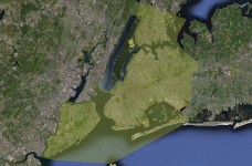
…is announced by Eric Sanderson of the Wildlife Conservation Society – whose Manahatta Project inspired some of my recent work including “Animal Estates 1.0: New York” at the 2008 Whitney Biennial and the “Lenape Edible Estate Manhattan” planted last year – and here is some info on the new project:
Ever wondered what New York looked like before it was a city? Welcome to Welikia, 1609. After a decade of research (1999 – 2009), the Mannahatta Project at the Wildlife Conservation Society un-covered the original ecology of Manhattan, one of New York City’s five boroughs. The Welikia Project (2010 – 2013) goes beyond Mannahatta to encompass the entire city, discover its original ecology and compare it what we have today. Welikia (pronounced “WAY-lee-ki-a”) means “my good home” in Lenape, the Native American language of the New York City region at the time of first contact with Europeans. The Welikia Project embraces the Bronx, Queens, Brooklyn, Staten Island and the waters in-between, while still serving up all we have learned about Mannahatta. Welikia provides the basis for all the people of New York to appreciate, conserve and re-invigorate the natural heritage of their city not matter which borough they live in. (website)

Recent Comments